


Schlagwort: Bam Dorner
Walter Schwarz feat Bam Dorner – Red Moon
Bam Dorner feat Elemental Child The Last Prophecy – Video
© Bam Dorner Production/Elemental Child 2021
Der Teppich ist von mir, um arrangiert von Elemental, der auch noch einige melodiöse Piano- und Bass-Läufe eingefügt hat.
Der Flötentrack ist von mir, leider mit Defiziten, da ich nur noch selten dieses Instrument spiele. Deswegen ist das Instrument mit einer MIDIspur gedoppelt, die eine Oktave tiefer gesetzt wurde.
© Bam Dorner Production/Elemental Child 2021
The carpet is by me, rearranged by Elemental, who also added some melodic piano and bass runs.
The flute track is by me, unfortunately with deficits, because I rarely play this instrument anymore. That’s why the instrument is doubled with a MIDI track, which was set one octave lower.
Edirol Orchestral VST now free(win VSTI x86)

PC Only! Edirol Orchestral is a dope discontinued VST that we can’t find anywhere. So we decided to share this with you as a free download! Contains realistic orchestral sounds and instruments! Premium acoustic sounds, focusing on Strings, Woodwinds, Brass, Percussion and Keyboards. Realistic articulations such as vibrato, tremolo, pizzicato,…
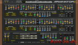
Arminator by Krakli-Plugins[Win][VSTI][x86]
Music-Society presents LA Partial v0114 by 2Lazy

Bam Dorner – Bario Gotico
Bam Dorner – Oderbruch
Das knapp 60 km lange und 12–20 km breite Oderbruch erstreckt sich zwischen den Städten Oderberg und Bad Freienwalde im Nordwesten und Lebus im Südosten. Zweitgrößter Zufluss nach der Oder — zugleich größter Nebenfluss der Oder — ist die Warthe, die gut 10 km nach deren Eintritt ins Oderbruch einmündet. Im Westen wird das Oderbruch durch die Hochflächen des Barnim und des Landes Lebus begrenzt, in deren Hanglage sich die Städte Wriezen und Seelow befinden. Die östliche Begrenzung bilden das Neumärkische Hügelland und die Wartheniederung. Unter Ausschluss der Neuenhagener Insel hat das Oderbruch zwischen Reitwein und Hohensaaten eine Gesamtfläche von 920 km². Westlich des Flusses ist es seit Mitte des 18. Jahrhunderts ein Flusspolder, während sich auf den 17 % der Fläche am Ostufer, heute in Polen gelegen, das ursprüngliche Feuchtgebiet erhalten hat. Der Boden des Oderbruchs bildet eine sehr schwach geneigte Ebene und fällt von 14 m im Südosten auf einen Meter Meeresniveau im Nordwesten ab. Der tief gelegene nur 2–6 km breite Teil westlich des Neuenhagener Sporns wird Niederes Oderbruchgenannt.
The Oderbruch, which is almost 60 km long and 12–20 km wide, stretches between the towns of Oderberg and Bad Freienwalde in the northwest and Lebus in the southeast. The second largest tributary after the Oder — at the same time the largest tributary of the Oder — is the Warta, which flows into the Oderbruch a good 10 km after its entrance. In the west, the Oderbruch is bordered by the high plateaus of the Barnim and the Land Lebus, on whose slopes the towns of Wriezen and Seelow are located. The eastern border is formed by the Neumärkische Hügelland and the Wartheniederung. Excluding the Neuenhagen Island, the Oderbruch between Reitwein and Hohensaaten has a total area of 920 km². To the west of the river it has been a river polder since the middle of the 18th century, while on the 17% of the area on the eastern bank, now located in Poland, the original wetland has been preserved. The bottom of the Oderbruch forms a very gently sloping plain, dropping from 14 m in the southeast to one meter sea level in the northwest. The low-lying part west of the Neuenhagen spur, which is only 2-6 km wide, is called Niederes Oderbruch.
© Bam Dorner Productions 2002
Interview von Ewart Reder mit Bam Dorner für RadioX(April 2020)

Im April 2020 hatte Ewart Reder ein Interview für das Frankfurter Stadtradio RadioX mit mir geführt.
Quiet City in Spring by Bam Dorner
© bam-dorner-productions 2020
1. Lockdown
War am Ostersonntag bei mir im Bezirk spazieren. Es ist erschreckend, wie leer die Straßen, dank Covid-19, sind. auf der anderen Seite ist auch Reizvoll. Dank der wenigen Autos, die unterwegs sind, ist die Luft sehr sauber.
Took a walk with me in my district on Easter Sunday. It’s scary how empty the streets are, thanks to Covid-19. On the other hand, it’s charming. Thanks to the few cars on the road, the air is very clean.
![Giulioz RdPiano (SA-synthesis Digital Piano) v0.2 VSTI3 AU STANDALONE Windows MacOS [FREE]](https://music-society.de/wp-content/uploads/2025/01/1737324771_2993323375-300x73.webp)
![Infected Sounds Brut4l (Minimoog Synthesizer) v3.0.1 x64 x86 VSTI VSTI3 Windows [FREE] free download](https://music-society.de/wp-content/uploads/2025/04/1743712063_4188947008-300x197.jpg)
![U-he Zebralette 3 Beta 2 VSTI3 CLAP AAX macOS Linux Windows [FREE]](https://music-society.de/wp-content/uploads/2025/04/1743773051_2300133719-300x176.jpg)

![Infected Sounds Skyl4r (Hybrid Synthesizer) v4.0.1 x64 x86 VSTi VSTi3 Windows [FREE] Free Download](https://music-society.de/wp-content/uploads/2025/03/484120632_535425156241499_6235364550553810724_n-300x215.jpg)


